About Online Course: History of Maps

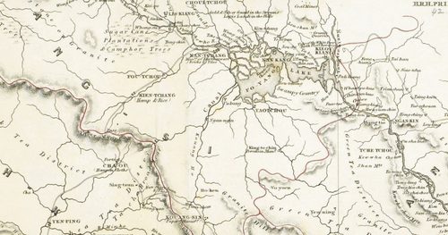
From medieval mappae mundi to modern transit diagrams, maps have always been more than just navigation aids – they are expressions of how people have understood and ordered the world. This six-week online course explores the history of both map-making and map-reading through the lens of ideology, imagination, and power.
In a centuries-long thematic survey drawn from the British Library’s rich cartographic collections, we will consider maps as cognitive systems, social constructs, and objects of material culture. Each session focusses on a small number of case studies to uncover the ‘secrets’ embedded within maps, both local and global, ordinary and ornate. A range of themes will be considered, from religious cartographies of the early modern world to the environmental, social, and cultural maps that continue to shape modern life.
Along this journey, we will encounter climate maps inspired by the Enlightenment, street-by-street diagrams of Victorian poverty, and the imaginative landscapes of authors and filmmakers. By tracing the shifting boundaries of cartography as science, art, and ideology, participants will gain a deeper understanding of how maps have constructed – and contested – the many worlds we inhabit.
No prior knowledge is required for this course.
This course takes place online on Microsoft Teams. Sessions are recorded and will be available to participants for a limited time after the session. Live-closed captions are provided. If you have any further access requirements, please email adultlearning@bl.uk.
Your support
The British Library is a charity. Your support helps us open up a world of knowledge and inspiration for everyone. Please consider adding a donation to your basket.
Jack Englehardt
Jack Englehardt is a PhD candidate in international history at the London School of Economics.
More
His research, supported by an LSE studentship, revolves around representations of tropical nature in nineteenth-century Britain, chiefly in popular literature such as illustrated magazines, textbooks, and school atlases. A specialist in literary geographies, Jack studies maps as cultural images, which help to define the exotic ‘other’ while giving spatial form to imperial notions of progress, civilisation, and improvement. In addition to his academic work, Jack is a qualified secondary schoolteacher who has taught both history and geography in London-area state schools.
Tom Harper
Tom Harper is the British Library’s Lead Curator of Antiquarian Mapping.
More
Tom Harper is the British Library’s Lead Curator of Antiquarian Mapping, and spends his time looking after and promoting Britain’s national historic map collection.
Tom’s publications include Atlas: A World of Maps from the British Library (2018) and A History of the 20th Century in 100 Maps (2014, with Tim Bryars). Tom co-curated the British Library exhibitions Magnificent Maps: Power, Propaganda and Art (2010), Lines in the Ice: Seeking the Northwest Passage (2014), and led the 2016–17 exhibition Maps & the 20th Century: Drawing the Line. Tom is a director of Imago Mundi and a trustee of the J.B. Harley Research Fellowships Trust.
Dr Paul Stock
Associate Professor of International History at the London School of Economics and a Fellow of the Royal Historical Society and the Royal Geographical Society.
More
He is the author of many scholarly publications, including Europe and the British Geographical Imagination, 1760–1830 (Oxford University Press). Since 2012, he has taught a graduate-level course on the history of cartography.
Course programme
Part I: The Map as a Cognitive System
Week 1 – Monday 12 January
How to Read a Map: Introduction and Theory
Tutor: Jack Englehardt and Tom Harper
What can a map reveal beyond the terrain it depicts? This opening week introduces key approaches to understanding maps as cultural texts rather than neutral records of space. Drawing on the work of critical cartographers like J.B. Harley and David Woodward, we will explore how maps serve as agents of authority, ideology, and imagination, and how informed map-readers can ‘decode’ these rich layers. Participants will gain an overview of the major traditions of cartographic thought through history, while considering how choices of projection, orientation, scale, and symbolism all shape our understanding of the world we all inhabit. Lastly, participants will enjoy a behind-the scenes introduction to the British Library’s own collections in the form of a conversation with lead curator Tom Harper.
Week 2 – Monday 19 January
Mapping Faith: Mappae Mundi and Medieval Cosmology
Tutor: Dr. Paul Stock
Medieval world maps, or mappae mundi, offer profound insights into how people once conceptualised space, faith, and knowledge on a single canvas. This week examines the map not as a literal representation of real places but as a visual theology – a tool for making sense of the divine order. By looking closely at examples such as the thirteenth century Psalter World Map and its contemporaries, we will discuss how these early works integrated biblical history, cosmology, and moral hierarchy into their depiction of the Earth. We’ll ask what it means to ‘locate’ humanity within the cosmos and how these maps framed a universal order centred on spiritual meaning rather than physical accuracy.
Part II: The Map as a Social Construction
Week 3 – Monday 26 January
Mapping Nature: Environment and Enlightenment on Paper
Tutor: Jack Englehardt
As scientific rationalism and overseas exploration transformed European thought, maps had to be re-thought to accommodate new places full of peoples, plants, and animals quite unlike those at home. This week explores how maps were converted into tools of classification during the early modern Enlightenment, becoming a means for humanity to measure and master the state of nature. We will examine how maps interacted with science to reveal complex environmental systems – from rainfall and temperature patterns to botanical kingdoms – and how these visual tools shaped emerging ideas about empire, modernity, and industrial civilisation. Participants will consider the double role of environmental maps as both instruments of scientific inquiry and imaginative projections, reflecting changing relationships between people and planet.
Week 4 – Monday 2 February
Mapping Society: Cartography and the Urban Milieu
Tutor: Jack Englehardt
By the mid-nineteenth century, cartographers increasingly turned the map inwards, looking to investigate both rapidly changing urban environments and the living conditions of their diverse inhabitants. This session explores the rise of social and economic mapping, as cartography became a key intervention in Victorian attempts to combat social ills, including poverty, crime, health, and inequality. We’ll discuss how positivist reformers like Charles Booth used mapping to reveal the hidden structures of urban life, shaping locational information into large-scale moral and political narratives. Participants will consider the power of Victorian maps to expose social problems, as well as the risks of turning human lives into spatial data. How does mapping shape the way societies divide themselves, and what ethical questions might they raise?
Part III: The Map as Material Culture
Week 5 – Monday 9 February
Mapping Movement: Transit and Tourism in the Modern Era
Tutor: Jack Englehardt
The twentieth century brought revolutionary forms of mobility, collapsing old notions of distance and inspiring new kinds of maps to match. This week investigates how the expansion of roads, railways, and air travel around the globe made the map an indispensable companion of modern living. Whether folded into pockets or printed in guidebooks, these everyday artefacts help reveal how map design influenced consumer perceptions and behaviour as the modern world took shape. We’ll explore the aesthetics and logic of travel, from schematic diagrams of abstracted space to tourist maps selling a particular standard of living. Participants will reflect on map-handling as a material encounter, in which movement becomes a daily act of orientation within the modern world.
Week 6 – Monday 16 February
Counter-Mapping: Imagined Worlds and Alternative Geographies
Tutor: Jack Englehardt
Our final week turns to the creative and subversive uses of maps. By turning to geographies from satire and works of fiction, we’ll explore how artists, writers, and filmmakers have redrawn the world to challenge dominant narratives. Participants will examine how maps continue to function even in openly fantastical spaces – charting not what is, but what could be. We’ll consider the continued cultural power of mapping as a form of metaphor: a means of reclaiming territory, identity, and imagination. In closing, we return to the course’s central question – what does it mean to ‘read’ a map – and reflect on how the act of mapping continues to shape our collective understanding of space, power, and possibility.
Previous skills, knowledge or experience
None required.
Course preparation and materials
Some course materials will be shared in advance of the first session.
Joining the sessions
A joining link will be emailed to you prior to the first session.
Accessibility
Online courses are live-captioned by Microsoft Teams. Pleaseemail adultlearning@bl.uk todiscuss your accessibility requirements.
You might also like
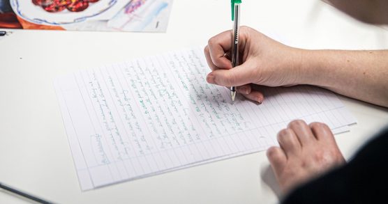
Creative Writing Masterclass: How to Write a City
Join writer Elena Medel for a creative writing masterclass focused on cities and the built environment.
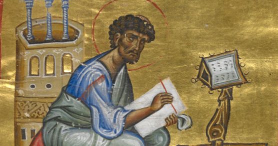
Illumination Masterclass
Join renowned scribe and illuminator Patricia Lovett MBE on this one-day beginners masterclass and create your own medieval miniature on vellum.

Bookbinding Masterclass
Take inspiration from one of the world's greatest collection of books, on this weekend masterclass.